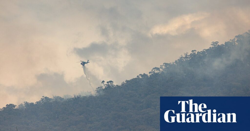
Milder conditions across the weekend will bring temporary relief to firefighters who continue to battle an out-of-control bushfire in Victoria’s Grampians.
But the forecast rain is not expected to extinguish the fires and hot weather is expected to ramp up again from Monday.
One home has been lost and seven sheds and other structures destroyed amid the bushfire in the Grampians national park, which is expected to burn for weeks to come.
The blaze, which has grown to at least 74,000 hectares and spans a perimeter of more than 640km, remained at a high danger level on Saturday as westerly winds swept the state ahead of a cold front.
Sarah Scully, a senior meteorologist from the Bureau of Meteorology, said the front would ensure temperatures remained “relatively mild” on Saturday, with some showers and temperatures ranging from 23C to 28C.
Temperatures were due to start increasing again on Monday but forecasters were not expecting the fire danger ratings to reach extreme, either this weekend or into the next, Scully said.
All emergency warnings had been downgraded by Saturday morning to watch and act alerts in and around the Grampians national park, but the area from Long Gully Road to College Road remained unsafe.
Hardship payments were made available for those with homes in evacuation areas or who had property damaged by the fires, via the state and federal-funded disaster recovery funding arrangements.
Assistance includes a one-off payment of $680 per adult and $340 per child up to a maximum of $2,380 for each eligible family to help cover the costs of essentials like food, clothing, medication and accommodation, the federal emergency management minister, Jenny McAllister, said.
Meanwhile, Melbourne was forecast to reach tops of 24C and 25C on Saturday and Sunday before jumping to a maximum of 29C on Monday.
In New South Wales, fire warnings were in place for Northern Slopes on Saturday, where a total fire ban was in place. Tamworth was forecast to reach a top of 36C across the weekend and 37C on Monday.
Sydney had a milder forecast, tipped for a top of 26C with potential showers.
As of 9am Saturday there were 58 bush and grass fires across NSW, with 17 not yet contained, according to the Rural Fire Service.
after newsletter promotion
Fire weather warnings were also in place for the central west coast of Western Australia, with hot, dry and windy conditions forecast. Further south in Perth, the temperature was forecast to stay in the low 30s until Wednesday, with a maximum of 38C.
Scully said Saturday would be a particularly hot day for north-east NSW and south-east Queensland. Brisbane had a forecast top of 37C, with “really high humidity.”
“If it gets to 37C as predicted, it will be the hottest day this year for Brisbane,” she said.
Ipswich was forecast to reach a top of 38C on Saturday, with an afternoon shower or storm, while Surfers Paradise had a top of 35C.
Showers and storms were forecast across north-east NSW and eastern parts of Queensland on Saturday, including Brisbane and the Gold Coast, with a possibility they would turn severe, bringing large hail and damaging wind gusts.
On Sunday a cool south-easterly change was expected to push the milder weather through south-east Queensland, and “bring a bit of reprieve from the high temperatures and heat waste conditions that they’ve been experiencing”, Scully said.
Darwin was set to hit 34C on Saturday, with showers and a possible storm. Adelaide was forecast to reach a mild 24C on Saturday, before climbing back to 30C by Monday. Hobart was also due for a mild maximum of 19C, with showers.
– with AAP

